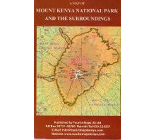
Travel Guide Map to Mt Kenya National Parks and the surroundings
Map of Mt. Kenya National Park. 1:150,000. Tourist Maps Kenya. A detailed hiking map of Mt. Kenya, based on Survey mapping and additional ground checking. The map shows elevation with color-shading, spot heights, symbols to show lodges, camp sites, observation towers, ranger stantions, air strips, springs, and much more. Descriptive text along the margins. At 5199m, Mt. Kenya is Africa's second highest mountain. The highest peaks, Batian and Nelion, can only be reached by mountaineers with technical skills. However, point Lenana the third highest peak, can be reached by trekkers. The summits of Mt. Kenya are surrounded by glaciers and often covered by snow. The mountain offers a unique mosaic of forest, moorland, rock and ice. Common animals include giant forest hog, tree hyrax, white-tailed mongoose, elephant, black rhino, bongo, leopard, and mole-rat.