Map of Kisumu County
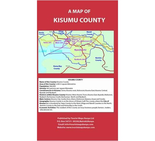
A Map of Kisumu County
Kisumu County covers an area of 2085.9sqkm. The County neighbours Siaya County to the west, Vihiga County to the north, Nandi County to the northeast, Kericho County to the east and Homa Bay County to the south-west.
The County has a shoreline on Lake Victoria. Kisumu stretches from the Nandi escarpment in the east to the Kano plains in the middle all the way to the hills on the west. Kano plains have black cotton soil which is very fertile.
The County has several inselbergs, mostly in Kisian area. Several rock outcrops also exist, the most famous of them being Kit Mikayi in Seme sub-county.
The climate of the whole county is modified by the presence of the Lake. The rain mainly falls in 2 seasons. Humidity is relatively high throughout the year.
Constituencies in Kisumu are Seme, Kisumu West, Kisumu East, Muhoroni, Kisumu Central, Nyando, and Nyakach.
Main Centres are Kisumu City, Sondu, Koru, Ahero, Muhoroni, Maseno and Awasi.
Economic activities include fishing at Lake Victoria and rice irrigation in the Kano Plains. There are also light industries and sugar factories.
Tourist attractions include Kit Mikayi and other rocks, Ndere Island Park, God Mesa viewpoint, Kisumu Museum and Impala Park.

Reviews
This product does not have any reviews yet.
Add your review