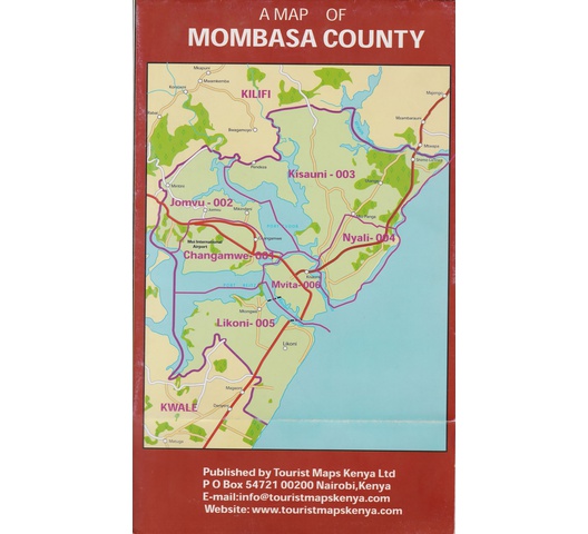
Map of Mombasa County
A Map of Mombasa County
The smallest county in Kenya, covering an area of 229.7sq km. It borders Kilifi County to the North, Kwale County to the South West and the Indian Ocean to the East.
Mombasa boasts of the only seaport in Kenya serving both Kenya and its landlocked neighbours. Has and an international airport, a train system, a ferry system and a highway making it well suited for its role as an import and export hub in the region.
Mombasa City is the second-largest in Kenya. It has a vibrant economy and is known for its varying hospitality amenities and beautiful beaches that make it a popular tourist magnet.
Mombasa is also Kenya’s 2nd major industrial hub after Nairobi with various industries such as mining, manufacturing and energy(oil refining).
Tourist attractions include Fort Jesus and Mombasa Marine Park.
Agricultural activities include growing of cashew nuts, coconuts, cassava, mangoes and vegetables.
Mombasa has six constituencies : Changamwe, Jomvu, Kisauni, Nyali, Likoni, Mvita.

| UPC | 2030308000191 |
|---|---|
| Author | Tourist Maps Kenya Ltd |
| ISBN | 2030308000191 |
| SKU | 2030308000191 |